|
Chris Cuomo, Wendy Eisner and Kenneth Hinkel,
"Environmental Change, Indigenous Knowledge, and Subsistence on Alaska's North Slope"
(page 3 of 9)
In initiating collaboration with elders of the North Slope we were
asking them to share their wisdom and experiences with us, for the
shared benefit of improved understanding of the landscape in warming
conditions. But the primary goal of the project was not simply to glean
information from the locals. We hoped that this research could benefit
the community, by providing an archive of videos and logs of interviews,
and making available our findings about local environmental change.
Because the North Slope Borough maintains a geographic information
system (GIS) with an indigenous knowledge component, for "documenting,
monitoring and managing resources, and assessing cumulative impact to
the marine and terrestrial environment,"[20]
we determined that a
relatively permanent way to make the information shared with us
available to the community was to develop a GIS based on the interviews,
which would ultimately be the property of the local community. A GIS is
a layered, multidimensional map that displays geographically referenced
data in a variety of ways, creating a powerful tool for managing,
analyzing, and querying spatial information. Through the GIS, all
geographically specific information provided by participants, which they
have given consent to share, can be accessible and available to the
local Iñupiat community for a variety of purposes, such as
analyzing patterns of environmental change, researching historical
sites, tracking changes in hunting, fishing, and berry harvesting, and
cross-referencing with other data.
Before embarking on the project or determining our specific methods
we held informational meetings and met with community leaders to
ascertain whether this sort of collaborative research and archiving was
desired. Other visiting researchers have worked with Iñupiat
elders, and in recent years a number of journalists have journeyed the
North Slope to gather first-hand accounts of climate change and
responses to planned expansion of oil drilling, so we were concerned
about contributing to "interview fatigue."[21]
We found that local elders
were quite interested in participating in this sort of research, and
nearly everyone with whom we spoke expressed curiosity about our
scientific project and a desire to share information about changes they
have witnessed in the landscape. Respecting elders' knowledge and
expertise is a common local theme, and people are quite aware of global
concerns about climate change. In addition, many residents of the North
Slope have some familiarity with the technologically intense petroleum
industry, which is widely regarded as a powerful partner rather than an
outside enemy, and that same attitude may extend toward scientific
research. Another contributing factor to the relatively positive
response to our research may be that in Alaska there are number of
institutions and organizations, such as BASC, the Alaska Native Science
Commission, and the Alaska Native Knowledge Network, which advocate for
native peoples' interests in relation to scientific
research.[22] It
seems that the existence of agencies whose work includes fostering
contacts between scientists and community members helped pave the path
for our collaboration.
As of July 2008 we have interviewed fifty-two Iñupiaq
residents of the North Slope Borough communities of Atqasuk, Barrow,
Wainwright, and Nuiqsut. Most participants are elders, and one third
(eighteen) are female. Participants are identified by asking local
contacts the names of elders with extensive knowledge of the landscape
and lakes of the area, and by snowball sampling, or asking interviewees
to recommend other possible participants. The elder whose initial
suggestion helped spark this research has often served as a "fixer" and
translator. Interviews revolve around detailed maps, such as recent
satellite images or official North Slope Borough maps that feature
native allotments. At the outset we tell participants that we are
studying the thaw lakes and how they form and drain, and that we are
interested in anything they know about the lakes, as well as any
landscape changes they have witnessed. We also let them know that we are
archiving the interview for the community, and that they are welcome to
share anything that they would like to have recorded. All participants
are asked if they are willing to sign a consent form, and the form
indicates that video and other records of the interview will not be used
in public without explicit consent of the participant.[23]
Each interview is rather unique, taking shape in relation to the
experiences and interests of the participant and the particular
dialogue that emerges. Even when arrangements have been made to talk
with one person, conversations often turn into group interviews, for
spouses, friends, and family members want to listen and contribute, and
sessions are seen as an opportunity to visit and share stories (see Figure 3).
Most interviewees are very adept at identifying locations on maps,
but careful to distinguish between things that they know directly, and
things that they are aware of only through hearsay. The time scale of
peoples' knowledge and memories vary, but regardless of the age of
participants, interviews inevitably include much discussion of landscape
and weather changes that have been noticed over the course of a
lifetime, or over a significant number of years traveling and engaging
in subsistence activities.
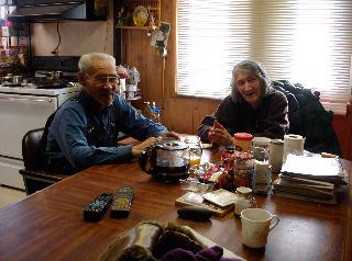
Figure 3
For Iñupiat who rely on hunting and fishing for basic
sustenance in the difficult environment of the Arctic, anything related
to travel is a matter of safety and food security, and so is of the
utmost importance. Travel patterns are quite seasonal and cyclical.
Hunting and time spent at native allotments revolve around predictable
patterns of animal migration, fish spawning, and berry ripening. Modern
travel over the tundra is by snow machine, four-wheel all terrain
vehicle, or motorboat, and existing trails and natural features are the
only landmarks in the flat treeless tundra. Although some participants
lamented a lack of knowledge of small detail, larger-scale changes in
the landscape and quality of the tundra (whether it is frozen, dry,
marshy, etc.) are unmistakable to the experienced traveler.[24] Those who
hunt whales and other sea mammals are also highly attuned to changes in
the location, depth, and quality of sea ice from year to year.
Each interview is carefully logged by two members of the research
team, who transcribe all substantive comments and encode every mappable
location for inclusion in the GIS. Of course, GIS technology is but one
way of capturing, displaying, and analyzing data, and not all of the
information given in interviews is geographically specific, or easily
translated into GIS points. For some questions or audiences the
narrative and interpretive information that is captured in narratives
and videotaped interviews is more important. For example, as the
testimony presented in the following sections show, Iñupiat
elders' responses to questions about their landscape elicit reflections
on life and livelihood that are quite compelling and instructive, and
much of the very important information and analytic wisdom conveyed in
the interviews is not geo-specific, or locatable on a map.
With the recent proliferation of projects integrating local knowledge
and spatial information technologies, a significant debate has arisen
about the usefulness of GIS and other technologies for indigenous
communities, and the tendency of such technologies to misrepresent
traditional knowledge, or to reproduce the values of researchers at the
expense of local communities' interests.[25]
Geographers Harris and
Weiner present a list of methods and approaches that help create a GIS
that is "community-integrated" and "progressive," rather than
reproductive of existing relations of power. They argue that a GIS
should be constructed with the assumption that local knowledge is
valuable and expert, the project should broaden community access to
technologies and data, and a GIS should integrate multimedia in order to
maximize accessibility to community members.[26]
While many of the
qualities recommended by Harris and Weaver have been integrated into our
methodology, the debate about GIS technologies continues to inform our
development of the GIS, our conversations with community members about
the format and future of the GIS, and our collaborations with the North
Slope Borough GIS office.
Interviews with Iñupiat residents of Alaska's North Slope have
generated important information about thaw lake processes and
environmental changes on the Western Arctic Coastal Plain, and we have
been able to corroborate participants' observations of past lake
drainage using satellite imagery and site visits via helicopter.
Interviews with elders have also validated the timing of landscape
changes studied by the physical geographers on our team, and provided
data that was instrumental in a recent analysis of the impact of climate
change on travel routes. Several scientific publications have resulted
from this research.[27]
But in addition to providing important
information that helps us better understand the dynamic nature of the
permafrost in northern Alaska, the interview process generates
qualitative information about general environmental change and
contemporary Iñupiaq subsistence practices and values. In the
following sections we discuss prominent themes that have emerged in
interviews conducted from 2003 through 2008, and present excerpts from
several recent interviews.[28]
Page: 1 | 2 | 3 |
4 | 5 |
6 | 7 |
8 | 9
Next page
|